Zoning Ordinance
Zoning Ordinance
The zoning ordinance document linked to this page is a publication of the Santa Clara County Planning Office and is formatted for ease of navigation. The official publications of the County Ordinance Code including the County Zoning Ordinance, may be obtained from the Clerk of the Board of Supervisors.
Zoning Maps
The zoning atlas is a very large file consisting of 281 map sheets (this is a large file and will take some time to open). Zoning and other information for individual lots is available via the Property Profile application.
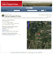
What's My Zoning? - Property Profile Report
A reporting tool designed to provide useful information about a parcel's location, jurisdiction, general plan designation, zoning, and other data of interest. We Also have an Interactive Property Profile, which combines our traditional Property Profile app with an Interactive Map.
Commonly Used Regulations
- Residential Development Standards
Standards such as setbacks and building height restrictions. - Calculate Building Height
Methodology to calculate building height on a hillside. - Fence Height
Regulations for fence and hedge heights in certain zoning districts. Reference table for Fence Height Standards. - Floor Area Ratio
Floor Area regulations controlling the maximum size of dwellings and certain accessory buildings (cumulative) pertain in –n Neighborhood Preservation combining zoning districts. - Secondary Dwelling Regulations
Information and restrictions on secondary dwellings. - Livestock Regulations
Information on various livestock regulations, depending on the zoning district. - Outreach
An update to the project notification policy to inform communities and property owners about nearby private development projects that may be of interest.
Change or Interpret Zoning
- Zoning Amendment/Rezone
The zoning amendment procedure is a discretionary review process to consider the rezoning of land, or the revision of specific policy language in the zoning ordinance. - Zoning Interpretation
The zoning interpretation procedure is an evaluation of the precise meaning of a particular zoning provision(s) as it may apply to a given circumstance.


